• Skip to primary navigation
  • Skip to main content
  • Skip to footer
DASUDA

DASUDA

Alliance for Sustainable Urban Development in Africa

  • Home
  • Partners
  • Themes
  • Projects
  • News
  • Team
  • Contact

Flood Resilience and Coastal Protection

Coastal Vulnerability & Protection for Monrovia

24/06/2023 by admin

Coastal Vulnerability & Protection for Monrovia Metropolitan Area

Coastal Vulnerability & Protection for Monrovia Metropolitan Area

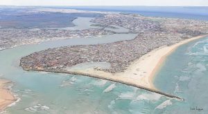
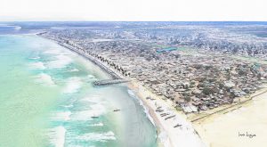
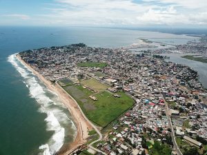
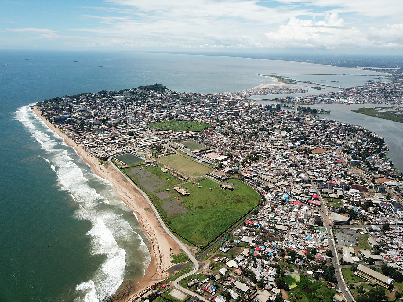
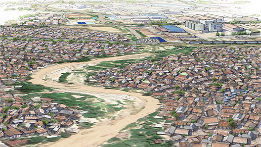
Location: Monrovia, Liberia
Project type: Vulnerability analysis, Feasibility study and Environmental and Social Impact Assessment
Year: 2018-2019
Client: UNDP
Consortium partners: CDR international, IHE Delft, Earthtime Liberia, Dryfeet, Shore Monitoring & Research

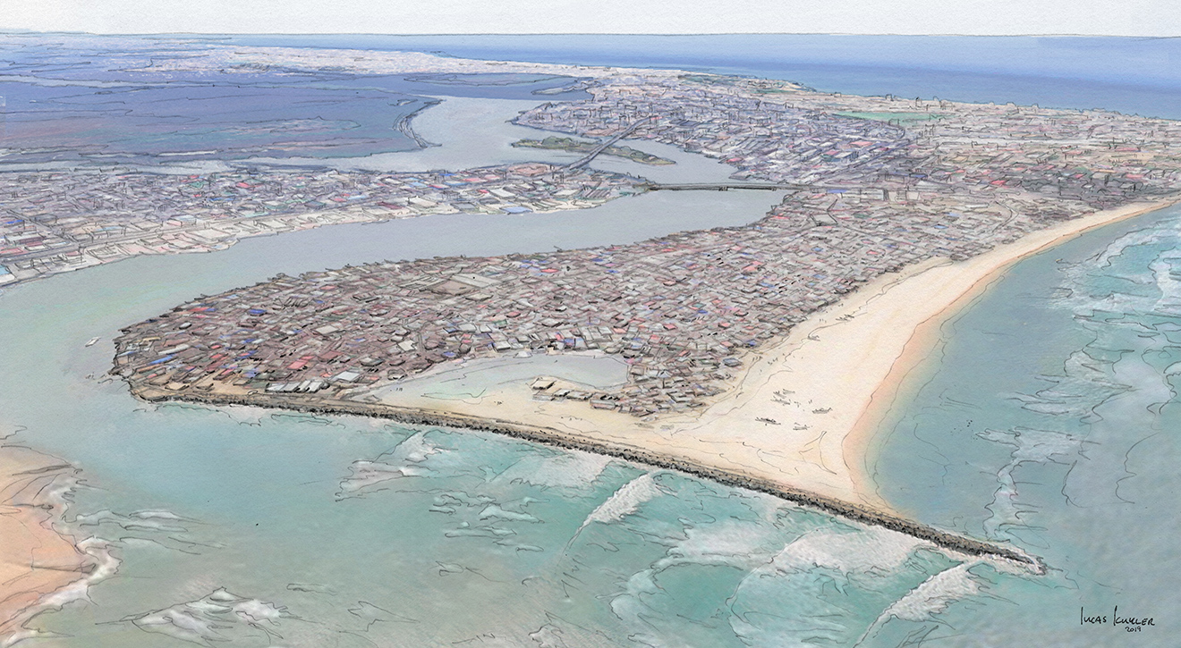
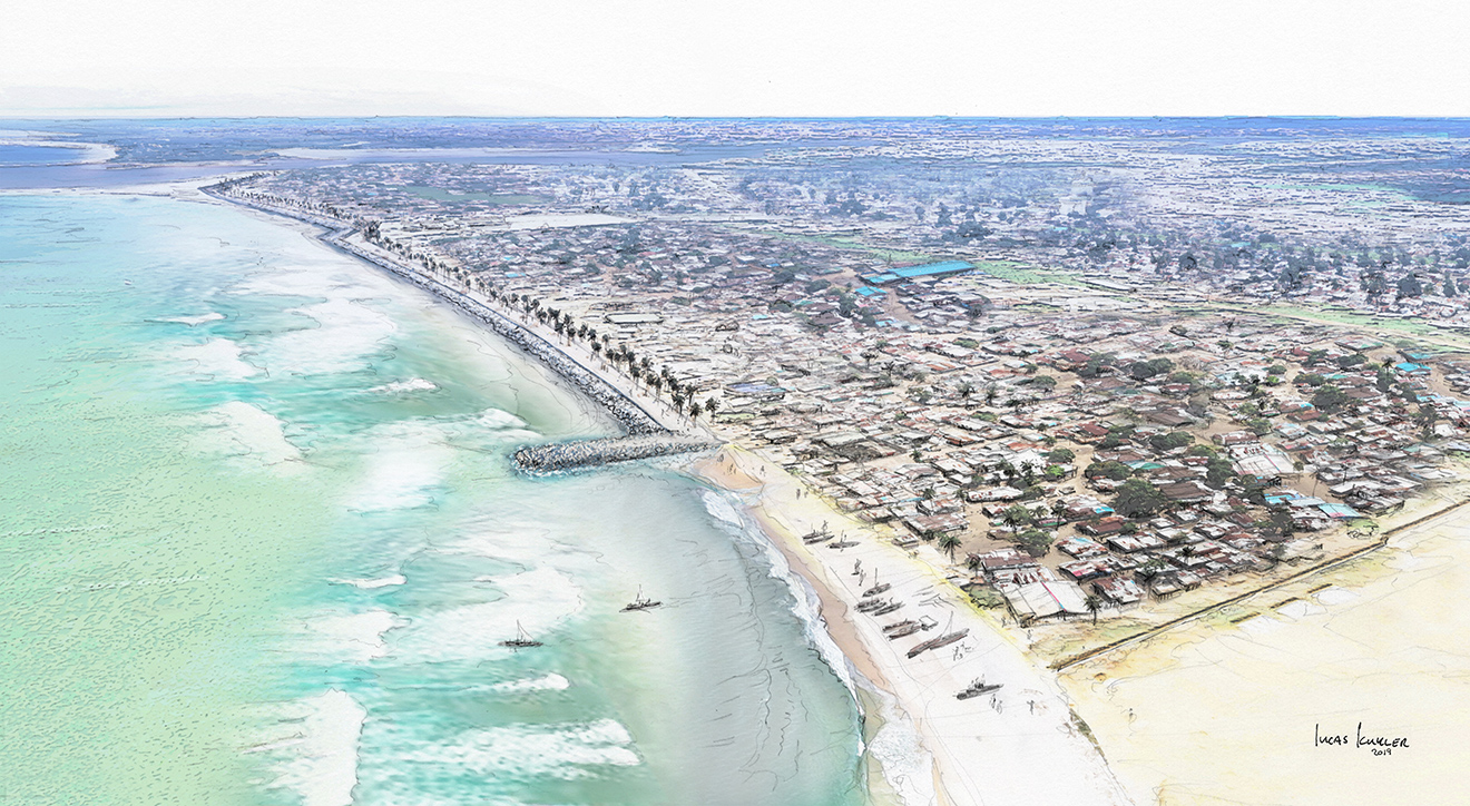
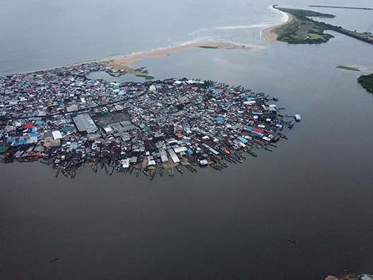
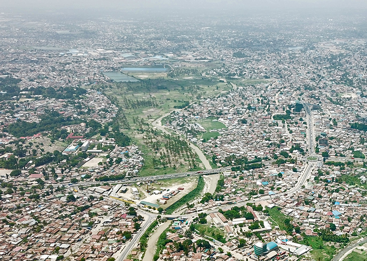
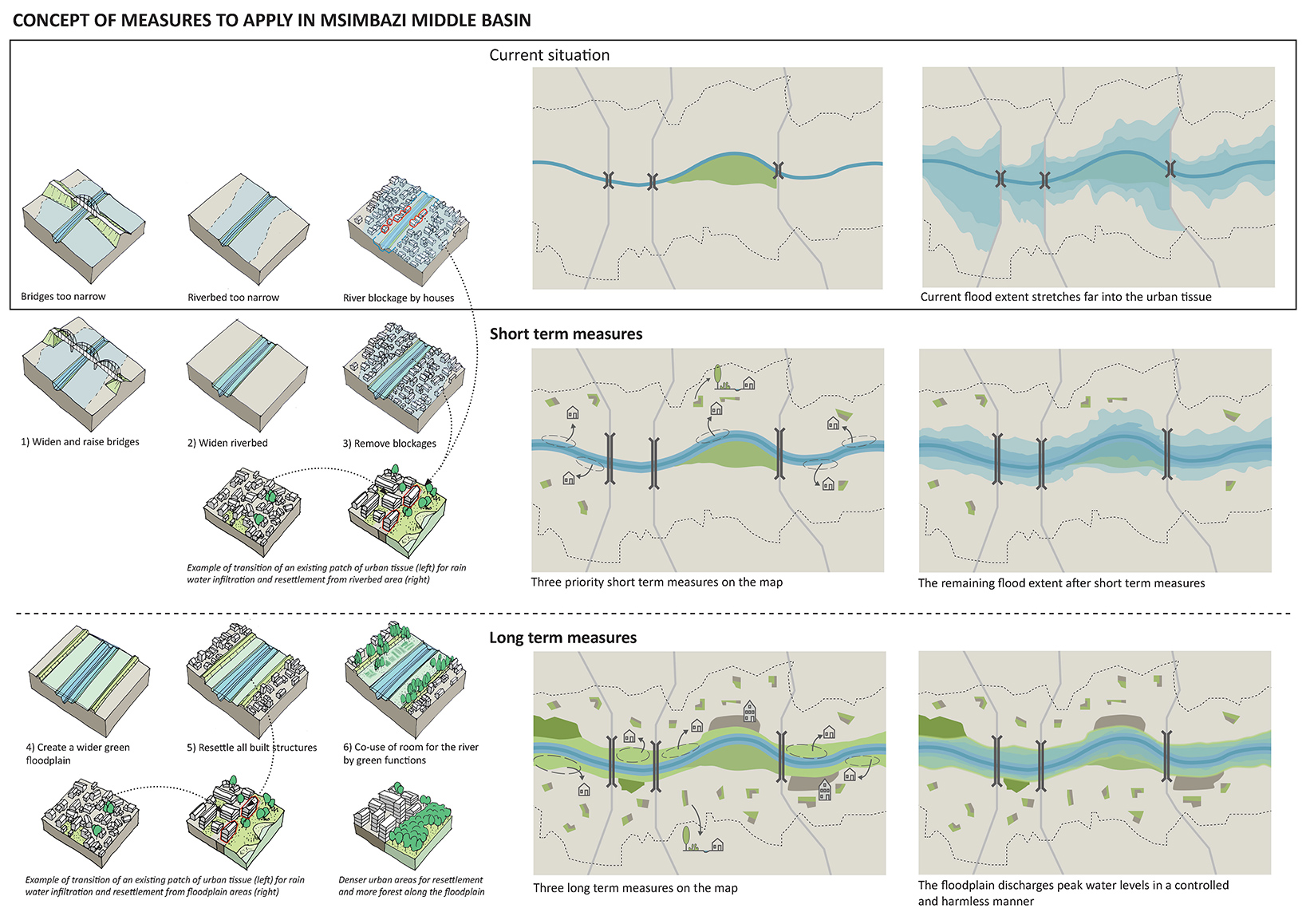
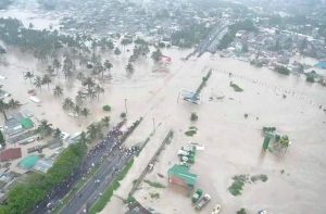
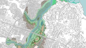
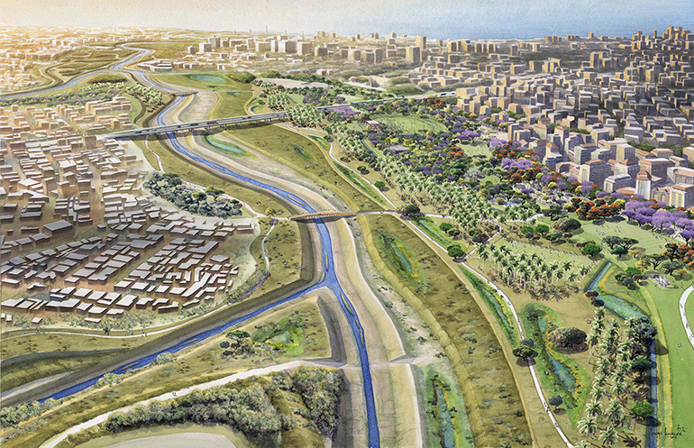
Coastal communities and infrastructure in Monrovia are vulnerable to climate change induced coastal hazards. Up to 2018 over 670 households are reported to have been displaced due to coastal retreat, which is the main coastal hazard causing impact. This project encompassed a detailed Vulnerability Analysis, Feasibility Study and ESAR for Climate Resilient Strategies, including adaptive and protective measures for the coast Monrovia.

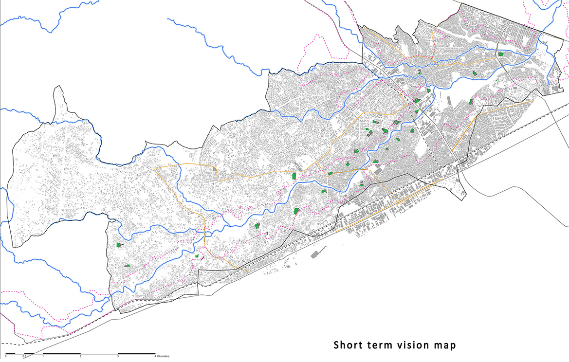
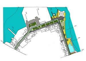
In the first phase, detailed numerical modelling of ocean conditions and coastal erosion for different climate change scenarios was done. Based on this, the most vulnerable communities were located, namely at Westpoint and New Kru town.

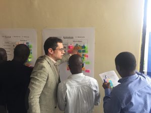
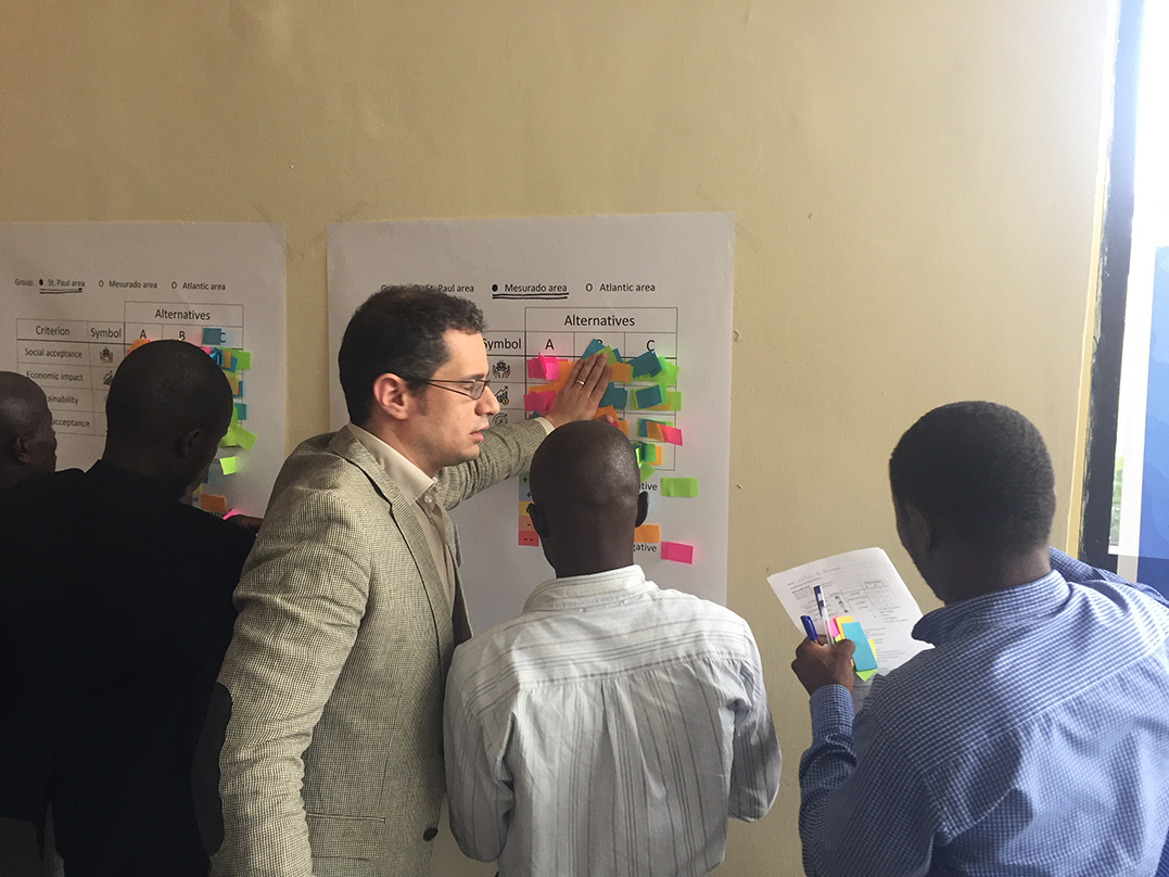
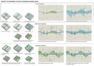
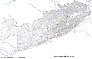
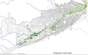
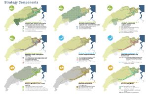
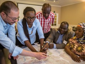
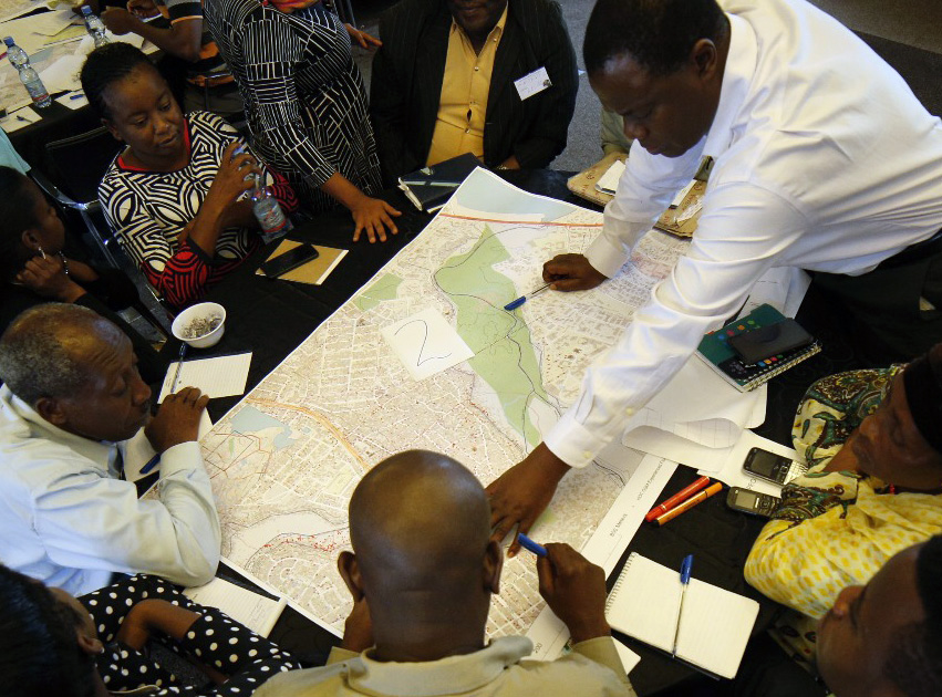
Together with the local stakeholders a Multi Criteria Workshop was done to evaluate several alternative coastal protection schemes. The results of the project has a twofold approach to addressing climate change, including:

  • Adaptive measures: measures to help minimise the drivers as well as the impacts of climate change and prepare awareness and capacities for implementation of the protective measures.

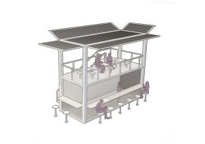
These exploit opportunities to safeguard currently sustainable livelihoods that are low consumers of carbon energy, and which consequently promise to give Liberia “green” living approaches for both the current and future generations. The project focuses on the inshore artisanal fishery of Monrovia, which contributes significantly to the city’s food security with very low carbon emissions.

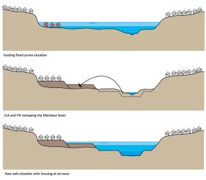
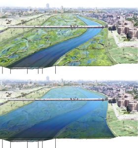
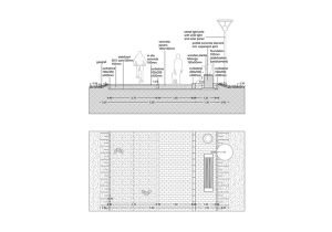
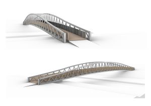
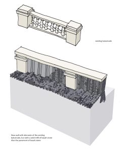
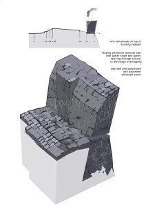
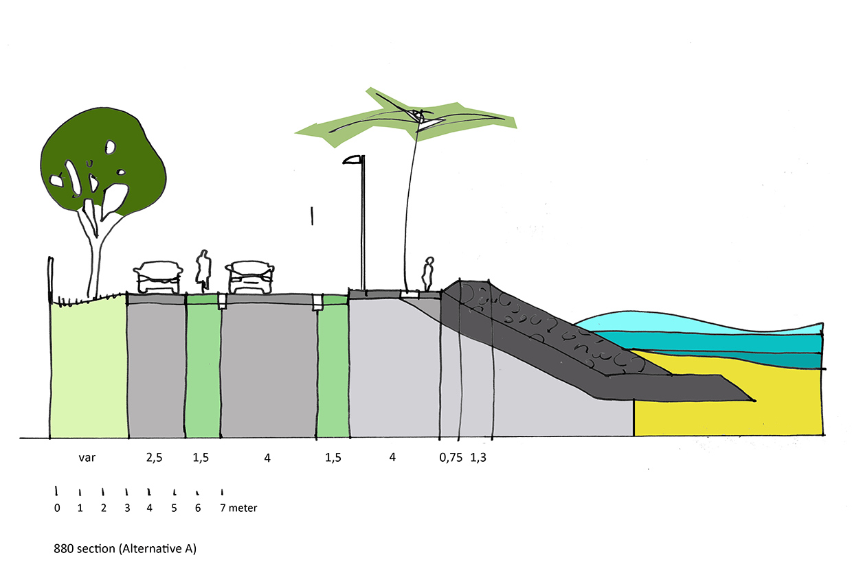
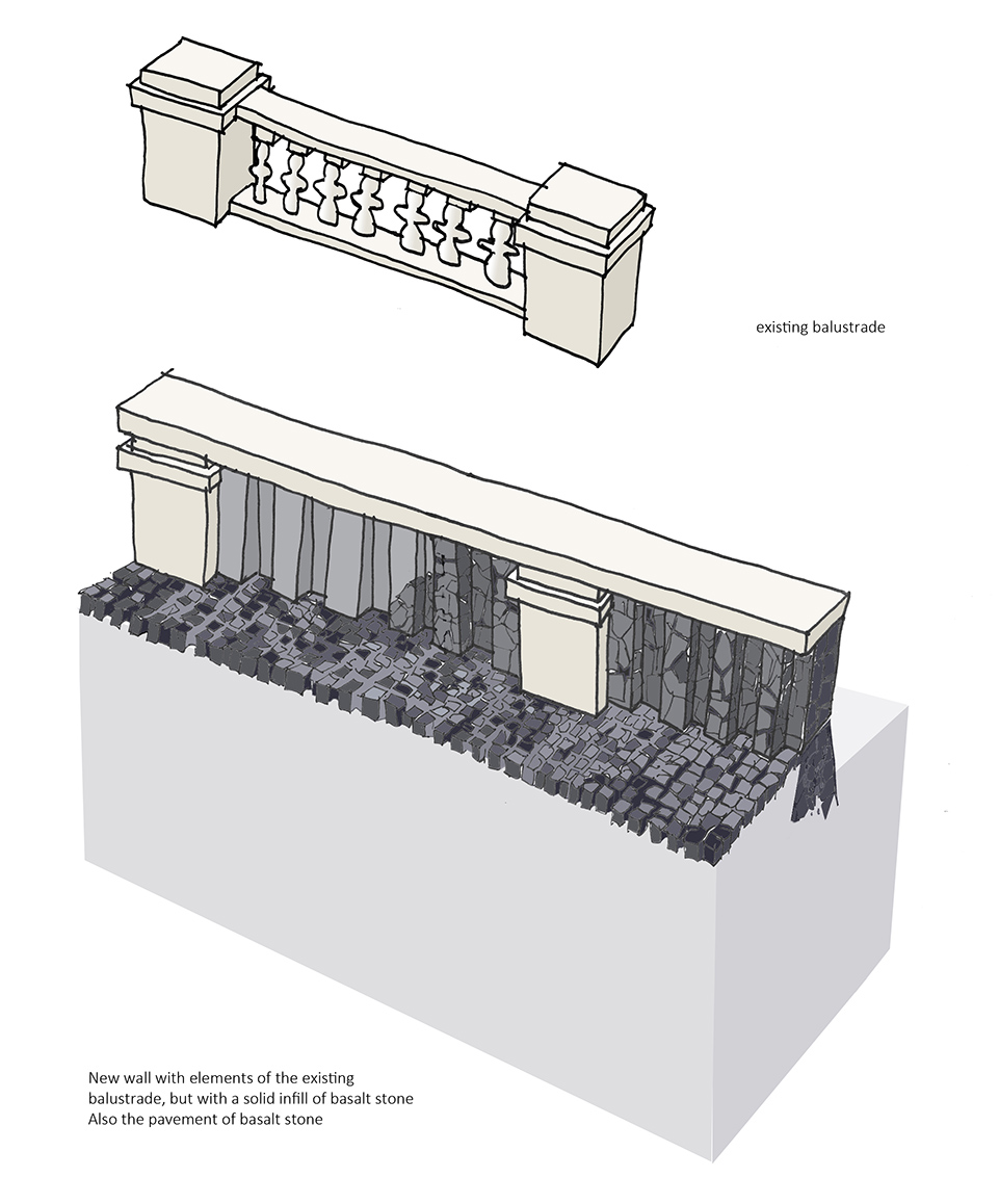
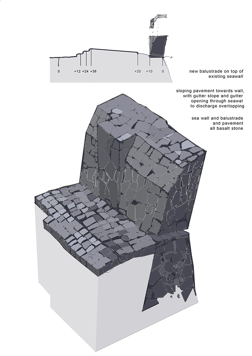
  • Protective Measures: measures to help mitigate the impacts of climate change. These are mostly engineered interventions such as the construction of revetments, groynes and beaches to protect against rising sea level and the damaging effects of waves from higher-energy storm events. Some aspects are preventative, such as the development of alternative sand sources to stop mining of the natural beaches, and the promotion of measures to improve infrastructure resilience.

The synergy between both type of measures is of importance. The adaptive measures are important conditions for the effectiveness and sustainability of the protective measures, but they also provide synergies within the strategy. The intention is that both types of measures must go hand in hand with each other. 

See all projects

Filed Under: Flood Resilience and Coastal Protection, Projects

Flood Management Feasibility Study

23/06/2023 by admin

Flood Management Feasibility Study for Msimbazi Middle Catchment Area

Flood Management Feasibility Study for Msimbazi Middle Catchment Area

Location: Dar es Salaam, Tanzania
Project type: Feasibility study and Environmental and Social Impact Assessment
Year: 2020-2021
Client: GIZ (Deutsche Gesellschaft für Internationale Zusammenarbeit)
Consortium partners: CDR international, VE-R, WEMA, Deltares

The Msimbazi River Basin (170 km2) is located in the city of Dar es Salaam, Tanzania, and for the last decade this is the city’s worst hit area by serious degrees of flooding nearly every rainy season. The floods are impacting the basin’s inhabitants and environment on different levels, like loss of lives, destroyed homes and assets, traffic interruption, siltation of areas and negative health effects of contaminated flood waters and stagnant ponding after the events. Flooding has become one of the main environmental issues in the basin and it is expected that the situation will get worse if no action will be taken. This assignment for the middle basin area follows the Msimbazi Opportunity Plan strategy and builds on the agreed principles.

After the identification and testing of efficiency of a set of prioritized measures, a flood risk management strategy was developed that was complemented with an urban strategy. These strategies were based on short-term component focussing on removing hydraulic bottlenecks and resettlement of the worst affected assets and people and a long-term component proposes a transformation of urban land use by making room for the river, urban regeneration to accommodate resettlements, and reforestation and re-greening of the catchment.

See all projects

Filed Under: Flood Resilience and Coastal Protection, Projects

Msimbazi Opportunity Plan

23/06/2023 by admin

Msimbazi Opportunity Plan

Msimbazi Opportunity Plan

Location: Msimbazi River Basin, Dar es Salaam, Tanzania
Project type: Vulnerability analysis, strategy and spatial plan
Year: 2018-2019
Client: World Bank (Tanzania) with PO-RALG
Consortium partners: Ecorys, VE-R, CDR International, Wema

The Msimbazi Opportunity Plan is a project in which the participatory design process had a central position in a series of charrettes with the stakeholders and communities that have an interest in and/or who live in the Msimbazi River Basin. This highly urbanised area in the heart of Dar es Salaam, with high percentages of unplanned development, is highly affected by flashfloods during the wet season, and draughts during the dry season.

Generally, flooding in the Msimbazi Middle River Basin is directly caused by five main factors;

  1. Insufficient hydraulic capacity of the Msimbazi River profile at certain locations,
  2. Back water effects and piling up of water upstream of structures, e.g. bridges, with an insufficient hydraulic capacity,
  3. Inadequate urban drainage infrastructure and inadequate solid waste management
  4. Decrease of ‘green areas’ in the catchment has resulted in reduction of infiltration of precipitation and a direct run off response and
  5. Settlement in the natural floodplain area.

The objective of this project is to facilitate a design process that tackles the multiple social and environmental issues that this basin is facing by aligning the different stakeholders and to collectively design i) a strategic and management framework for the entire catchment area and ii) a detailed plan for the Lower Basin within the catchment. This has resulted in the Msimbazi Opportunity Plan, a basis for all further development and implementation projects and processes in the coming years in the river basin.

See all projects

Filed Under: Flood Resilience and Coastal Protection, Integrated urban development and landscape design, Participatory design workshops, Projects

Lower Msimbazi Upgrading Plan

23/06/2023 by admin

Lower Msimbazi Upgrading Plan

Lower Msimbazi Upgrading Plan

Location: Msimbazi, Dar es Salaam, Tanzania
Project type: Feasibility study and detailed design
Year: 2021-2023
Client: PO-RALG (Presidential Office, Regional Administration and Local Government of Tanzania
Consortium partners: CDR International, VE-R, Deltares, Norplan, Deltares, Shore

The Lower Msimbazi Upgrading Project (LMUP) is a crucial initiative aimed at improving the resilience of the city centre of Dar es Salaam. The focus of the project is on the lower Msimbazi river and its tributaries which are prone to severe flooding that poses a threat to livelihoods, properties, and critical infrastructure. The consortium was hired to conduct the Feasibility Study based on the Msimbazi Opportunity Plan strategy and prepare preliminary and detailed designs with cost estimates. Objective is to make a robust flood resilient solution and to incorporate a City Park, infrastructure solutions and new floodsafe urban development areas.

The most essential flood protection principles and measures designed for the LMUP are:

Increase hydraulic capacity

Through widening and deepening the river channel by means of excavation, the overall hydraulic capacity will be increased. Furthermore, a higher and wider bridge has been designed to replace the existing Jangwani Bridge, preventing traffic disruptions, while lowering the extreme water levels upstream of the bridge.

Creating room for development by creating room for the river

It is proposed to largely restore the floodplain area to a more natural state. To achieve this, the current bus depot and a large part of the building stock will have to be moved to new areas and the sediment accumulated in the floodplain will be removed. With the dredged material from the river and floodplain, flood safe terraces will be created that are suitable for relocation, urban development and recreation. The transitions from the flood safe terraces to the floodplain areas will be fixed with bank protections.

Rehabilitation of natural hydrological system

These measures have the purpose to mitigate flooding along with associated (additional) benefits, hence making the impacts of climate change less severe. In the LMUP it is envisioned this will be mainly achieved by reforestation of the upper basin area and rehabilitation of vegetated areas. This will reduce the sediment load in the long-term while providing additional benefits.

Adaptive operations and maintenance

Operation and Maintenance activities are essential to ensure the long-term effectiveness of the proposed interventions. These activities are formulated as a set of recommendations that go hand in hand with the implementation and execution of the sediment management plan.

Feasibility study

The feasibility study served as the basis for securing investment financing. The Spatial Framework was developed as a central tool while working with a multidisciplinary team on the variety of tasks and subjects. It spans 200 hectares, including the river and tributaries, floodplains, urban agriculture, public park, sand depots and mangroves. Preliminary designs were made for embankment protections, resilient transport infrastructure, urban greening and nature revitalization and the City Park. The public park is divided in high and low activity zones and connected by a Non-Motorized Transport network. An urban plan was also set up, including diverse neighborhoods with a mix of affordable, social, mid-end and high-end housing.

The detailed designs focus on the park’s structural elements, such as the path systems, drainage systems and vegetation layers. The vegetation plan includes ca. 100 different species of trees, carefully chosen to match the specific characteristics of the site. The urban agriculture terrace will provide ideal conditions for farmers with establish coconut trees, fruit trees and water bodies to increase water security. The Non-Motorized Transport network will connect the surrounding neighborhoods to the park, accessible for pedestrians, disabled individuals and cyclists. The boulevard, between new neighborhoods and the City Park will offer a versatile space for walking, biking, running, relaxing and gathering with beautiful views over the Msimbazi basin. Reference designs were made for various park facilities, including kiosks, washrooms, sport and play fields, promoting physical and mental health and serving as gathering places for the community. The festival terrain remains a central destination that can accommodate thousands of visitors and is accessible by bus and green car-parking space.

Links: https://www.worldbank.org/en/news/video/2022/11/22/strengthening-climate-change-adaptation-and-resilience-in-flood-prone-dar-es-salaam

See all projects

Filed Under: Flood Resilience and Coastal Protection, Integrated urban development and landscape design, Projects

Água Grande District Coastal protection

12/06/2023 by admin

Água Grande District Coastal protection

Água Grande District Coastal protection

Location: Água Grande, São Tomé and Princip
Project type: Vulnerability analysis, Feasibility study and Environmental and Social Impact Assessment
Year: 2017-2018
Client: Ministry of Infrastructure, Natural Resources and Environment (MIRNA), funded by Rijksdienst voor Ondernemend Nederland (RVO)
Consortium partners: CDR International, REBEL group, IHE Delft, VE-R, Move Mobility, Shore Monitoring & Research

The coastal area of Água Grande district covers an area of 16.5 km2 that ranges from São Tomé airport to the community of Praia Melão. The district includes both the Bay of Ana Chaves and the Praia Lagarto Bay. The two bay areas suffer from the consequences of strong sea turbulence mainly caused by the rise of the sea level and increased storm events related to climate change. The main infrastructure located along the coast, including access roads, pavements for pedestrians, small boats of artisanal fishermen, protective walls, among others, have been suffering from accelerated and regular degradation. 

In this project a solution driven approach, focused on a feasible coastal protection design, was combined with a multi-sectoral approach, by integrating different sectors including but not limited to tourism, fisheries and urban planning.

A vulnerability analysis to assess the hotspots for coastal erosion and damage to coastal infrastructure. Hydrodynamic modelling of storms was done to predict storm erosion for beaches and damage to the coastal structures and roads.

Based on the hotspots and wishes of stakeholders to upgrade the coastal road infrastructure, three  alternatives were defined for coastal protection and road rehabilitation. The focus with the alternatives was multi-sectoral, including areas for tourism and areas for fishery. The designs for coastal protection built upon the existing structures in combination with soft solutions such as beach nourishments. For this purpose in Ana Chaves bay, fishery landing sites were incorporated in the design and a promenade was included along the strengthened seawall. In Lagarto bay, a beach nourishment in combination with revetment was proposed where steps were included in the revetment at several locations to allow for beach access.

See all projects

Filed Under: Flood Resilience and Coastal Protection, Projects

Footer


“Sharing our experience and expertise to improve the urban environment in African Cities on a larger scale, broader network and integrated manner..”

Contact information

Wijde Geldelozepad 11a
2012 EJ Haarlem
The Netherlands

info@dasuda.nl

Lead partners

❭❭ BKVV
❭❭ CDR
❭❭ Move Mobility
❭❭ Rebel
❭❭ VE-R


Copyright © 2025 · DASUDA


Made with love by RaketNet